This year's edition of the Strong Machine's MSAR was based out of a fresh new location, in the historic coastal town of Brunswick. The coolest part of this race was that we would be racing with original teammate Nick for the first time since the 2019 MSAR, as our original 3-man unit (Est. 2009).
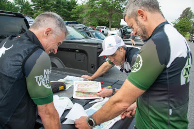
Pre-race, we picked up our maps and had about 2 hours to finish gearing up, map our initial legs and stuff a few more calories in the tank. It seemed like a lot of time, and it was, but we did not let that stop us from spending the last 10 minutes in the usual chaotic frenzy.
 |
| Tailgate mapping session |
The prologue of this race, we then found out, was going to be a written quiz on topographic features. We needed to ace the test before we could begin the race proper. This went pretty well - after a quick correction of the quiz, we were off on bikes, 6 minutes earlier that the loser quiz-failer teams.
Race weather was much sunnier overall than predicted, but it was never excessively hot or extremely humid - it could have been much worse, given the jungle-like weather of the early summer so far.
We biked briefly on local roads to a Line-O on the local Neptune Woods trails. You just had to follow a course through the trails, marked on your map, and encounter the 4 unmapped CPs. This was fun and easy. The trails were smooth and dry and the CPs were obvious if you were on the right course.
Next, we spent a little longer riding roads around the Brunswick Air Force base to reach the trails of the Kate Furbish Preserve. Here we dropped bikes and spent an hour or so finding 10 CPs in the woods. We had no real problems here apart from wet feet and a few mosquito bites. We trotted back to the bikes at TA1 and sped off toward the next leg - paddling in the tidal Androscoggin River.
After logging more miles on road and smooth trails, with no major delays, we reached the put-in (TA2). At this point we were about 24 miles and 3.5 hours into the race.
Here we were reunited with our gear bin (food, fresh gear, sunblock) and we carried our 2 kayaks to the boat ramp on the Andro. There were 7 paddle CPs available. 2 of them were located together, quite a distance downriver. We had calculated that it would take 1.5-2 hours to get these 2 CPs and had previously decided that they were not worth it. You would only go for them if you were confident of clearing the rest of the course and we decided we weren't. Since the first legs of the race had gone so smoothly, we were second-guessing this a bit as we started the paddle. However, we soon realized that we did not even have the map for those 2 CPs with us in the boats, so it was pointless to debate. It ended up being the correct decision.
We enjoyed the paddle. With no competition nearby, we just clicked into a solid paddling rhythm and found the 5 island CPs without issue, while taking some time to eat and drink. It was a little sunny and uncomfortably warm but there were a few breezes (and hat dips) that helped. It was nice to hit the turnaround point of this roughly out-and-back journey and have the benefit of a substantial current for the last couple miles. We covered about 8 miles in about 2.5 hours.
Back at the TA, it was time to switch back into bike mode for a long (20 mile) ride to Popham Beach State Park on generally scenic rural coastal roads. There were lots of rolling hills and historic residences to add variety. The non-rural exception was a quick trip through the busier port town of Bath, early in the leg. We were with several other teams for a few miles after Bath, but soon outpaced them and got to pedal by ourselves for most of the trip, until catching solo Tom Martin near the end of the leg.
 |
| Nick leading the train out of Bath |
Sunset (and the accompanying mosquitoes) was looming as we transitioned at Popham into trek mode for a beachy and historic circumnavigation of the Popham peninsula. One cool feature of this section was that there was a CP on an offshore island which was accessible only during a 4-hour period at low tide.
 |
| Island CP |
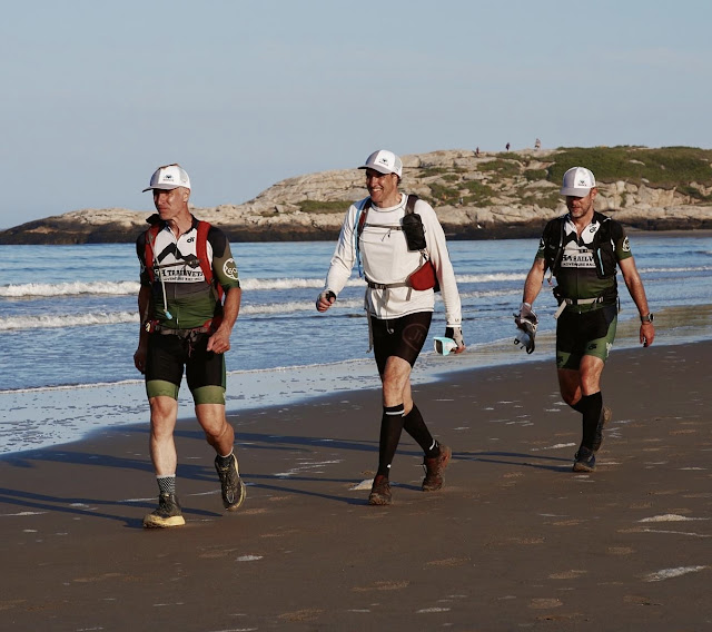
Our arrival coincided with the beginning of that 4-hour window, so we grabbed that one first. We then continued walking along the scenic and expansive beach for 2 miles to pick up another shore CP before heading to a cluster of CPs that were within various historic forts/bunkers on the northern end of the peninsula (adding about 3 more miles). The last part of this was wooded and pretty full of mosquitoes. This left us a bit concerned about bug pressure for the many hours of woodland trekking that lay ahead of us tonight.
During this beachy section, we made the decision to maintain a fast hike, even though some teams around us were shuffling/jogging and outpacing us. The race was only about 40% over at this point and, none of us being big runners, we wanted to make sure we had legs to last to the end, even if it cost us 10-15 minutes in the short term.
 |
We needed to find a couple CPs along the way; the coolest was a CP hosted by Maine Oyster Company. We had been forewarned about this CP, which would require each team to shuck and eat an oyster before continuing. Since Rob and Nick both do surgery, it was decided that my hands were least valuable and therefore I would be doing the shucking. It was trickier than it looked in the video tutorial but after a couple minutes, the oyster was open and I was happy to slurp it down (plus a bonus, professionally-shucked oyster). Its always a treat to get fresh food during a race.
Then it was back out onto the roads toward the trek. The only wrinkle here was that we accidentally overshot CP 42 and, by the time we realized it, we were quite a bit past it. So we decided to skip that one and use the saved time for the rest of the race (a long trek leg and a long bike leg remained).
When we arrived at the start of the night trek it was about 11:00 PM, a bit past the halfway mark in the race. We took a few minutes to change into dry shoes, get water and eat a few bites of much-appreciated food provided by the RDs (ramen and sandwich wraps).
In this night trekking section, there were up to 16 CPs to be found, on and off trail. The trails were of varying levels of quality/visibility, leading to some question as to which were on the map. I hatched a route plan which would direct us to 9 of the CPs and skip over the 7 which were on the other side of a paralleling highway and river. In retrospect, I should have been more aggressive here but I knew there were a lot of bike CPs waiting for us after this (which I wanted to get all of) and I played it conservatively (spoiler: we finished 1.5 hours early). Night navigation is no guarantee and 9 CPs and 10 miles of trekking could take us more time than budgeted.
The best surprise during the leg was the near-total absence of bugs! After the wet, warm and humid summer we've had, we came into the race armed with multiple DEET options, adhesive deer fly patches and even full face/torso bug mesh jackets. We didn't need any of it for this section. We hadn't experienced any significant bugs apart from the dusk trek on Popham Beach. We were incredibly thankful for this unexpected level of Maine Summer comfort.
As the trek and associated nav went fairly well, we got back to the TA at about 4:00 AM. So we had 6 hours remaining to complete the final bike leg to the finish. We saw that the leg was composed of a lot of road miles plus 2 embedded singletrack sections. After taking time to attire ourselves appropriately and grab some food/drink to go, we were off on the quiet local roads.
We covered 25 miles during this leg. The road miles were pleasant and straightforward. When we hit the first singletrack area, the Lily Pond trails, we were met with a sloppy rutted uphill muddy ATV track just after dawn. Ugh. Things improved a bit after this rough start; the trails were wet, rocky and rooty for sure but it was doable. Our main problem was not the trail conditions but staying in touch with the map - there were lots of confusing trail junctions and we found at least one inaccuracy. We ended up spending a lot of time with veteran family racers Scrambled Legs and Aching (including their 2 badass kids) and working through this dilemma with them.
We eventually escaped by just riding singletrack until we found something that we could sort of locate on the map and then just work in the general direction we wanted until we were sure of our location. Once we found ourselves on the map, we made quick work of the CPs in here and were soon back on smooth roads.
The next singletrack section (the Kate Furbish trails again) was much more user friendly. Rob directed us efficiently through the 3 CPs here and then we drilled it to the finish line around 8:30.
We had efficiently covered 111 miles and found every CP we looked for (58 total) without much trouble. We ended up in 7th place overall out of 39 teams, first in the men's division.
I think this was my favorite MSAR (I've done all 6 previous editions). The coastal routes, the beach trek, the oysters, etc. kept reminding you that you were in Maine, rather than some random patch of forest. We'd like to give a huge thanks to the Kate and Cliff and the rest of the Strong Machine crew that made this happen, as well as the race sponsors and volunteers. We're so thankful that people choose to arrange these things in their spare time. We'll be back for sure.


No comments:
Post a Comment