Reed was willing to double his previous max effort and try out a 24 hour race this year, so we signed up for the Maine Summer AR. Pam and Eliza would run the 3 hour. Rob joined forces with Untamed NE. As last year, the race was HQ'd out of the well-suited Outdoor Center at Pineland Farms.
Reed and I drove up that morning - race start wasn't until 10:00 AM and only 1.5 hours from home. We got there at 8:30 but were one of the last teams to arrive and I felt hurried to get us all ready to go; the maps got a very cursory perusal as prep time quickly elapsed in stressful fashion.
Quick editorial: I love the 10:00 start time for a 24 hour race. I understand that race day logistics limit RDs' leeway in race start/finish times but having to wake up at 4 or 5 AM to begin a 24 hour race already at a sleep deficit is no fun. I say this as a person who suffers the effects of sleep deprivation much less than the average person. Getting a normal night of sleep before this race was great. Thank you Strong Machine!
The race began with a prologue on bike. We sent one teammate (Reed) ahead and then I had to use a map and then find a map (mem-O style) to find the teammate. The last MSAR (2019) featured a prologue in which each team member did their own mini orienteering leg. This really split everyone up nicely and there was little follow-the-leader to begin the race. Much of this year's prologue felt like a bike race - packed together with a bunch of other racers and hard to stay together, pass anyone or navigate independently on the Pineland Farms trails. We picked up the first CPs of the prologue (A through D) with one minor nav mishap. Then I directed us out of the trail system and onto the roads, past race HQ and blazing downhill toward CP1.
Hmm, where is everyone? We were all swarming around the trails together and now me and Reed are alone. I look down at my bike map board at my detail map containing prologue points A-D. I have a vague memory of hearing/reading? something about CPs E or G? I pull over and find the map which contains the full prologue, points A-G, uphill from our current location. Ugh. I'm really killing it here as our team captain - 2 nav errors in the first hour of the race.
We grind up the big hill we just descended to enter a trail system, grab the next CP (E) and head toward F. I take us on one wrong turn but soon we're on track to F on some pretty cool bike trails. The trails become a tangle of unmapped intersecting trails, I make my best guess as to the route and we never encounter F. I decide to leave it behind and move on to G. We bike through there on some mostly rideable stuff including:
 |
| ...some piney duff |
 |
| ...and dewy hayfields |
and then punch out onto pavement for the next bit of riding. We grabbed a few straightforward CPs en route to Range Pond State Park.
Signing up to race in July, I had some trepidation about heat and bug-related stressors. Reed and I are both fairly (highly for me) heat intolerant. It had been humid but not hot, so far. We were definitely warm and sweaty on the initial bike leg but not too bad considering it was mid-summer. It had been 90F the prior day, so we weren't complaining.
After arriving at TA at the Pond, we encountered our gear bins and a "mini AR" (short bike, trek-swim and paddle of 4 CPs each). We could choose the order. The decision was bike first or bike last, so we would only have to change shoes once; we chose bike last. First we set out on the trek-swim.
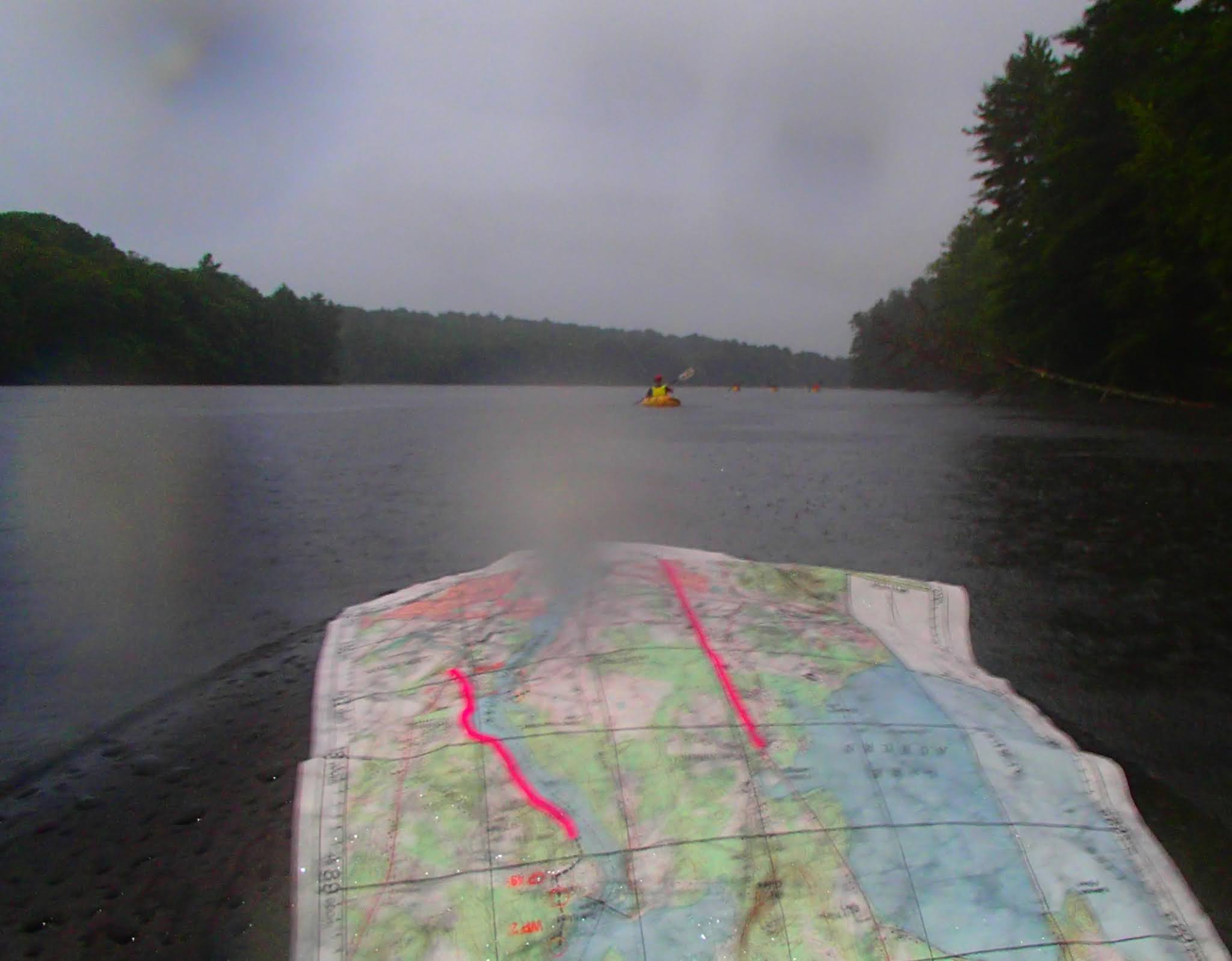
We easily grabbed the first trek CP and headed to the next 2. The obvious features petered out as we approached these and I did a poor job of keeping us on track. Consequently, finding the next CP (9) took too long, including an intentional interception of the backstop (a road) and re-attacking. The next 2 were fairly easily found and then came the swim! I always appreciate a swim during a race. I had one pair of webbed neoprene swim gloves from the old editions of GMARA's Bitter Pill when it included a swim stage. We each donned one glove and set out to a CP on a buoy as a rain shower stippled the water.
 |
| being careful not to drop my camera here in the middle of the pond |
Next we tackled the kayak. This was a fairly straightforward flatwater (pond) paddle. One interesting moment was when we had to hit a CP on the top of an island hill. To speed up our transit to the next CP, I dropped Reed off at the edge of the island and paddled around to pick him up on the other side. When I paddled around however, there was no "other side." Vegetation had filled in the "water" shown on the map. Luckily Reed quickly discovered this and found me without issue.

Following this we made our final transition at TA1, to bike mode, and headed to the nearby trail system. These trails were not too technical and pretty fun however the recent shower wetted the ample roots which crisscrossed them, making it a bit slick, so we had to be more careful (slow). We found these CPs fairly quickly, but guessed wrong for CP 15, tackling the outer loop of Rock Rings trail first (the CP was unmapped on the inner loop)
When we were done with these trails, we checked in to TA1 for the last time. We grabbed some food and our trekking shoes from the gear bin and departed on bikes for stage 3 of the race (the 3 disciplines at Range Pond were considered to be one stage - the mini-AR). This stage would involve a road ride to the Mt. Apatite bike trail system near Minot, Maine. On the way, we passed a general/country store. We weren't sure we had enough food remaining for the race (I'm not used to budgeting for an 18-year old's appetite) so we stopped in. We were a little disappointed to see that they primarily sold what we already had - convenience store fare - but we did score a couple homemade muffins and a their last donut. As we were leaving, we hear the guy behind us in line (who had been talking our ears off) order "a couple cheeseburgers" at the counter. What!? We very nearly went back in but, in the interest of time, gobbled the donut, stashed the muffins and rode on.
The Mount Apatite trails were nice - pretty flowy and more rocks than wet roots, so we could move a little faster. There was an easy way to grab 4 of the 6 CPs here plus a 5th from the road on the way out. We were near the back of the race and needed to streamline our approach in order to be sure that we had time to complete the longest stage of the race, still ahead of us, the trek-packraft.
On this section there was a neat CP in the bottom of a quarried pit which required a scramble, which was fun. As we worked through the trails here, night fell and bike lights came on. We had run into another father-sons team a few times in this race, composed of long time GMARA RD Chris Yager and his boys, also doing their first 24 hour race. We finished up this leg alongside them and would repeatedly tackle parts of the course with these guys for the rest of the race. The enthusiasm level of these kids was really impressive. We were able to find most of these trail CPs in the daylight but the last one (20?) in the dark, on twisty, slow, incompletely mapped trails, took up quite a bit of time. Without the "You are Here" maps scattered around the trails, we might have spent the night in there.
We wrapped up this leg on the road, having covered 15 miles on the stage. We ended at TA2, the start/end of a trek/orienteering section (Stage 4) at Lost Valley Ski Area. At the TA, after contributing the recommended donation, we had access to cooler of drinks - nice. We opened them to find that the selection was 95% Monster Energy. Not being "energy drink" aficionados, we were a little leery but figured we'd each slam one before heading out into the many hours of night racing which awaited us. But, then I noticed that each drink contained 160mg of caffeine - whoa (plus other ingredients of unknown effect) and figured that might not be wise for Reed - a non-coffee-drinker. So we split one and headed out onto the course.
Our chosen attack was to crank directly up the ski hill and then get the 2 CPs which were up on the ridge there. After a slow but fairly brief grind to the top followed by ridge traversing, we grabbed the first CP without much issue and then doubled back for the second. The clue was "re-entrant" and we had been warned that the reentrants might be subtle in the dark. This one took a while, but I eventually figured out where we were, after overshooting it. There were a few teams around including one whose strategy for finding the CP was to stand on the trail and watch my headlamp as we searched and then ask "Was it down there?" This happens occasionally in AR and puts you in the annoying position of either being a dick or giving away the fruit of your labor/skill. I have been that team many times before: demoralized, tired and wasting time wandering around the woods at night, hoping to glom onto someone else's success. It's an unavoidable part of AR, but the direct ask from someone who has not contributed to the search is always unwelcome.
Following this we cruised downhill to our next target. We decided to drop 2 CPs here in order to position ourselves to finish on time. This last CP (25) looked pretty simple on paper. I think it was pretty simple, off paper, as well but I butchered it. I just couldn't make my brain fit with the map. I still don't understand what happened but eventually we stumbled across it after 30 minutes of wandering back and forth on trail, off trail and in creeks. Reed dutifully followed as I incompetently dragged us around and drained our morale bar. After working though a patch of knee-high weeds he asked: "Uhh, Dad, what does stinging nettle feel like?"
We marched back to the TA, leaving 2 of the 5 CPs behind but using up plenty of time - not a high point. From here we transitioned back to bike mode to begin a night time bike stage (stage 5). The first part of this was a linear road that turned into an easy rail trail. There were 2 CPs to get from the rail trail. The first was super simple, the second (CP 29) located at the ruins of a long gone hotel which once overlooked Lake Auburn, looked fairly easy, not far from the rail trail. It ended up being a bit tricky though. The main wrinkle was that the CP was mapped on the outside of a trail loop/jughandle but in reality, the existing trail extended further north and the CP was actually now on the inside of the trail loop. There was a historical placard and map which indicated this difference, which I eventually found. The problem was that I was again having trouble syncing my mental map with the trail I was riding. There were a lot of back-of-the-pack racers around in this area and they were all looking for the CP in the wrong area (outside of the trail loop). Although I was convinced that they were off track, my inability to mentally sync the terrain was sapping my confidence and preventing me from making the move, away from everyone, to where I thought it would be. When I suggested it, Reed responded dubiously: "You mean up there, where no one is?" It took talking through it with our GMARA friends before we built enough of a consensus to head in the correct direction. Very soon, we were in the ruins, which were kind of cool-creepy in the dark forest and no one around.
The next task was to continue biking, on road primarily, to arrive at the trek-packraft section. There was a route choice here - a shorter hilly route or a longer flatter route along the banks of the lake. I directed us onto the latter, which was pretty easy and, I believe, the correct choice. We covered another ~ 13 mi on this bike leg.
 |
| Photo and custom lighting by Cliff White |
We arrived at TA3, the beginning of the packraft, leg a little after 2:00 AM. The Good To-Go (race sponsor) hot meals had all been eaten but race staff fixed us some instant hot mashed potatoes which were really tasty and appreciated. Here I was reunited with my camera, which I had left in my PFD pocket (not the first time I've done this), which explains the absence of pictures since TA1. The race notes recommended that we be rafting down the Androscoggin river by 4:00 in order to allow adequate time to finish before the 10:00 AM race end. By the time we were fed and packed with trek and raft gear, it was about 2:30. Taking into account the time to prepare the raft, etc. before entering the river, there was not much more than an hour to spend on the land CPs of this leg. The route was thusly straightforward: we would hit CP 31 in the nearby woods and then make our way to CP 30, near the bank of the river. This all went well, I felt alert, in sync with the map, and navigated to these CPs without issue. The only concern I had was wondering what the riverbank terrain would be like. Would it be suitable for a put-in? Riverbanks can be heinously choked with alders, steep or otherwise unnavigable. When we bushwhacked down to the river, after CP 30, however, we found a perfect gentle sandy beach to launch from.
In the early AM darkness, I inflated the raft while Reed assembled the paddles and attached glowsticks to our PFD and the raft (do this pre-race next time!). Looking around our put-in site, I notice this big dock spider (aka fishing spider) perched on our inflatable seat. These are the biggest spiders you will find in our area.
 |
| Dock spider photo: Spider Girl on Pinterest |
 |
| Snug in the packraft |
 |
| Post dawn river view. I was really impressed by the waterproofness of these paper maps. I hardly used a map case the entire race. Here I just suctioned it to the wet raft, which held it perfectly. |
 |
| Photo: Randy Erickson |
No comments:
Post a Comment