First of all, I like everything about this race - in nearby Vermont, organized by GMARA and most importantly, in the FALL. Anyone who has read my race reports knows that cool weather is the best weather and that the default mid-summer timing of most ARs is a source of endless whining. Luckily a COVID cancellation of a conference freed Rob to join me. We almost roped Nick into joining last-minute but in the end, we would be a 2-man team, while Nick and spouse Alison, who have a house in Burke, played the role of super hosts. Pizza, beer, campfire conversation, scrumptious breakfast sandwiches and coffee were supplied in addition to a comfy bed, 20 minutes from the race start, which was in St. Johnsbury. Nick and Alison's daughter-in-law, Britt, would be competing as part of a 2-woman team called "24 hours? I thought you said 2-4 hours!"
 |
| AM map sesssion. Photo: JS O'Connor |
We got to race check-in early (7:00) which gave us 2 hours to fuss with the maps before boarding a bus to the race start, somewhere. Once we got the maps, we found out that "somewhere" was the northern end of gorgeous Lake Willoughby, about 15 mi south of the Canadian border. Inspecting the maps and instructions, it seemed like a very ambitious course - lots of legs and terrain to cover as well as a "mystery" leg. It seemed like we would need to strategically drop some checkpoints in order to get to the finish on time (10:00 AM Sunday). This was confirmed at the pre-race powwow, where longtime GMARA spokesman Chris Yager instructed us to decide which CPs to drop in order to allow sufficient time to finish in 24 hours. All of the CPs were optional but full-course ranking required you to work through all of the legs/transition areas. Placing would be determined by number of CPs found, assuming you completed all the legs.
 |
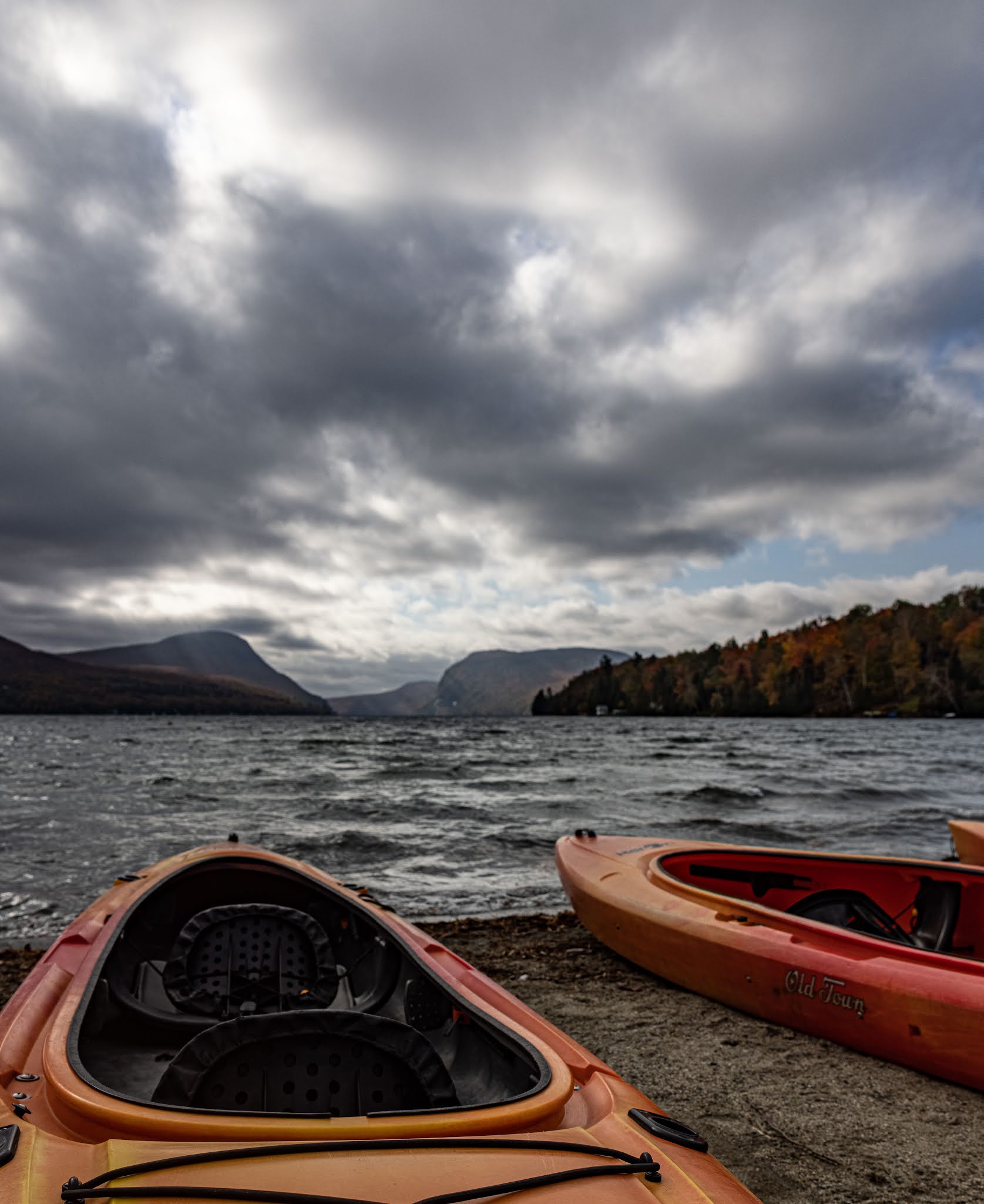
| Race start. Photo: JS O'Connor |
Arriving at the lake, the first thing we noticed was the robust southern wind that we would be paddling directly into, which was raising some surface chop and small whitecaps. We threw on protective layers and hopped into our 2-person kayak, started our GPS trackers and headed out onto the water. While Rob and I were actually moving well considering the wind, our kayak was taking on a significant amount of water. Every minute or two, a little wave would break over the bow of the kayak and deposit a few cups of water onto me and into the cockpit. This was no big deal initially, but obviously, as this continued it could become quite a big deal. We found that the best way to limit this was to closely draft nearby team Rootstock Racing's canoe. This was initially easy but, as more and more water ended up in our boat, it became more difficult and then impossible. About 2/3 of the way across, we needed to head to shore and dump out water. After this we resumed our previously good speed. We heard that several teams behind us required assistance on the lake, including a capsizing - quite an intimidating start to the race. I was a little bummed that the immediacy of the paddling situation occupied the attention we could have payed to the incredibly scenic surroundings.

After covering about 5 miles in 1.5 hours, we were the 3rd boat out of the water. We quickly transitioned into dry shoes, ditched our paddle stuff and headed out onto the first trek section next to the lake. For this scenic and mountainous area, we had been given a map with lots of possible CPs of varying point values. To get full credit (9 CPs) you needed to accumulate 900 total points (or less if you were cutting CPs here to save time) in any combination/order you desired. I'm sure that our planned route was not the best possible but I think it was pretty good. It was fun to think it through and strategize our approach during the map session earlier this morning.
The seriousness of the topography quickly made itself known. Our second target was only about 2 cm away on the map but directly uphill. This wasn't even a particularly steep part of the map, but it was almost a scramble - dragging yourself up with saplings and employing quadrupedal traction on the steeper sections. After a couple of these sections, we were really feeling our quads and wondering how those upcoming bike climbs were going to feel after a few more hours of this
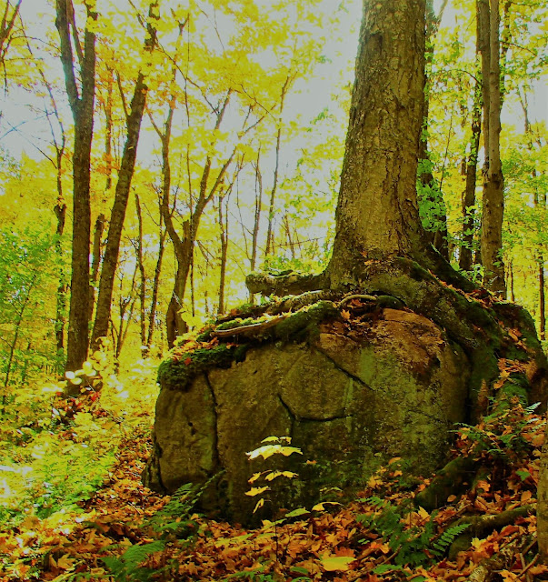
We gradually worked our way through 900 points of CPs here, which meant finding all but 3 or 4 of them. I navigated well during this section, with only minor delays and getting lucky at times. The off-trail travel was variable: we worked through nice open hardwoods as well as some post-logging brushy crap, cumbersome sidehilling over deadfall, and butt-sliding down the steepest stuff.
We punched the last CP at a waterfall, above, and bushwhacked to the TA2. We had cleared the maximal 900 points from this section, which equated to 9 CPs, while covering 10 miles and a couple thousand feet of elevation change.
Although it was October and it was Northern Vermont, it wasn't all that cool (temperature) for the trek. Rob and I had both blown through our water reservoirs in a couple hours and were feeling a bit parched to begin leg 3 which was a road ride to the Mystery leg. During this 10-mile stretch on gravel and pavement with plenty of hills, we kept our eyes open for an available homeowner. We finally encountered one near the end who, as they usually are, was more than happy to let us tap a few liters of water from his spigot and chat about what we were doing.
As we neared the end of the bike route in rolling rural terrain in Sutton, VT, Rob correctly guessed what the Mystery leg was going to be...a corn maze! This was a clever and fun idea to incorporate into a race, plus, it provided a nice change of pace because you couldn't move very fast while navigating the tight mazes.
Upon arrival here at TA3, we learned that we would be navigating 3 mazes for a total of 8 CPs. The first was a small maze on bike with one unmapped CP. The other 2 were much larger and very detailed, the aerial view of each depicting an impressive design. You only knew the location of the next CP, which was revealed on a map at the preceding CP. The bike maze was more challenging in that you could not really travel at bike speed while keeping track of all the intricate turns and intersections. The foot maze, while challenging, was easier in this regard.
Night had fully set in by the time we completed the 3 mazes and their embedded CPs, so we took some time before leaving the TA on bike to rig our lighting, add a little clothing (which I regretted as soon as we hit the first hill) and scarf down some food. Being this late in the season and this far North, the race would include at least 12 hours of full darkness - we had lots of backup batteries.
 |
| Post-corn maze, pre-Kingdom Trails Photo: GMARA |
Now our task was to bike toward the beloved Kingdom Trails, with whom RD Tom Martin had scored a permission. We knew we would spend most of the night on and around them - cool. We rode several miles to our first trail and began a mostly singletrack leg which would cover about 22 miles over 5-6 hours. During our time here, we needed to find the CPs which had been marked on the topo maps by figuring out which trails they were on, on the trail map. This is an exercise we had lots of experience with from prior GMARA races. Despite having a detailed trail map and the fact that the trail intersections were generally well-marked, it did take a bit of periodic double-checking to stay 'found'. Rob's bike nav kept us on track, with only a few minor delays here and there. We encountered 2 longer delays, one at CP 13, where the clue read "Pine tree at edge of marsh." As you see in the photo below, it is on a spruce tree. This was a bit misleading because there were quite a few actual pine trees in the area, which we spent a lot of time inspecting for the flag. It was also not exactly on the edge of the marsh, so a lot of teams were having delays here.

I have had this occur to me several times in races where the clue states "pine tree." Since a lot of people use that term to refer to any conifer, you have to try to guess at the RD's level of tree nerdiness. Our other delay was 100% on us - we were on the wrong trail bend. Kingdom trails are great, flowy and have some amazing swooping downhills. After several hours, however, our legs were starting to feel the last 12 hours of hilly racing and our caffeine levels were low. We were still moving fairly well through the course but the energy/pace was flagging as we went deeper into the leg. Fortunately Rob's nav remained solid as he successfully guided us through a trail system which contained 3 unmapped CPs.
After refilling water reservoirs with some water that was most likely potable (bike wash station), we worked deeper into this leg, grabbing the last several CPs on the way to TA4. The literal high point of this section (and figurative low point) was CP25. This point was located partway up a steep, continuously uphill, unridable technical hiking trail that we would have to hike-a-bike in it's entirety. I really can't recall a more physically intense CP effort than this one. In all, this climb was about 800ft, pushing bikes, wearing backpacks and burning through our calorie, hydration, electrolyte and enthusiasm reserves. Wow, what a beast. Partway up, we realized we could have easily bypassed it and, even more frustratingly, Strong Machine told us post-race how they attacked it as a simple out-and-back, on foot, from the top.
Gah. With that behind us, the rest of bike leg was easy, fast downhill on forest road, to TA4, grabbing one more CP, cliffside, before cruising into the TA. On the bike leg, we had scooped up all but 2 of the regular CPs and also skipped 2 Bonus CPs. We arrived here too late to do the nearby foot orienteering course, but that was 100% fine, as we had basically decided to cut that section - an off-trail foot-O at night was not our preferred method to maximize CP acquisition efficiency.
At this TA we had our only access to our gear bins, so we restocked food and water, switched maps, tried some Good-2-Go Cuban rice and headed back up the dirt road. This was followed by a zooming descent on similar roads, before reaching some paved roads that would take us to TA5 after only 7 miles or so. Here we would be reunited with our boats for a paddle down the Passumsic River. It was about 4:00 AM.
The beginning of the paddle was a bit chaotic. There were several teams very close to us in the water and water levels were low. This necessitated periodic exits to pull the kayak along the gravelly bottom to deeper waters. In less than an hour, however, we were in deeper, slowly moving water and had paddled free of the crowds, by headlamp. Within the first few miles, we faced 2 portages around dams. Both of these, but particularly the second which contained an unwelcome little hill, required substantial effort. There were many fallen trees on the portage trails, as well, which added to the general unwieldiness of the endeavor. It seemed like these portages were weighing on a lot of tired teams, as dawn broke on the river. I think we passed 5 teams during the first portage.
With daylight brightening the air, we were feeling quite a bit rejuvenated, compared to the dark bike leg. A riverside CP which required a chilling shallow river wade spurred us to a warming brisk paddle afterward. We kept at this pace, making great time down the river and enjoying the waterfowl and other morning scenery.
When we arrived at the third portage, we noticed the large bike-carrying rental trucks were parked nearby and then we noticed the race directors approaching us as we exited the river with our kayak.
They had made the decision to allow teams to bike from here to the end-of-paddle TA rather than paddle an additional 6 miles to it, in order to speed up the course. We were allowed to continue down the river and complete the full race course but we would not be ranked above teams that chose to bike. Hmm. We were moving well and feeling good on the paddle and had enough time left but, heck, if we could bike to the end without penalty, we surely would. This would allow us a shot at the 3 trek CPs near the finish. Post race, though, I question this decision by the RDs. All teams had been warned, in no uncertain terms, about the length of the course and the need to skip stuff early in order to finish on time. The blame for any lateness in that situation should lie completely on the racers' shoulders. Based on the state of the race at the time of the decision, it seems like 1/3 - 1/2 of teams had a good chance to finish on time, so I don't understand the need to intervene.
I really hate to critique the way races are run because I am so thankful that anyone goes through the immense personal effort of organizing ARs. I understand that the RDs are operating on limited information and limited sleep, and that the best possible decision is not always possible, when made on the fly during evolving race conditions. It's very easy, with the luxury of hindsight and unlimited time to analyze all of the factors, to lob a criticism. I definitely would have rather run the course as it was originally intended, but it was still an awesome course.
Anyway, back to the race.
Since we were the first team to be pulled off the river, all of the bikes were not yet unloaded, so we and race staff unloaded some more until we found ours, buried in the second truck. Soon we were off toward TA6, which was a few hills and miles away on the backroads north of St. Johnsbury (the straight shot, Rte. 5, was off limits.)
We arrived in town and hustled to the final TA to grab the last 3 CPs available before the nearby race finish. We had less than 2 hours to transition twice, do the trek, and bike to the finish. After a quick switch to trek mode, we set off for the 3 trek CPs. We found the first without too much delay and then headed up a large hill to find the next. There were several teams around and more arriving continuously, as we all converged on the end of the course. We attacked the off-trail CP too early and got off to a bad start. This was followed by a few more poor attempts, while watching the teams in the area and hearing the clock in our heads. I was not mentally in good place to competently navigate us and we ended up wandering around the area of the 2nd CP for quite a while but not finding it. With one hour to go, we made the decision to just bail on this section and truck it in. This required a downhill run back to TA which ended up being very brief and left me wishing we had spent more time up in the woods, digging out CPs. Oh well. We rode strongly to finish line, after a backtrack at the bridge to avoid Rte. 5, and rolled in with 30 minutes left on the clock.
Strong Machine won the race, with a really impressive race plan, navigation and speed. At the award breakfast, we were surprised to be announced as the winners of the 2-person male division, because we had assumed NYARA's Courain Bros. had outraced us. This actually turned out to be true - oops. I think we finished 5th or 6th overall - final results are still pending. We had a nice breakfast provided by GMARA, chatting with the other racers. We were happy with our race, all told, and felt that the course design and local autumnal terrain were especially great. We are hopeful that this great new fall race becomes a regular thing.
Huge thanks to the immense efforts of race creator Tom Martin and the typically stellar team of GMARA organizers and volunteers. We appreciate all that you do!


No comments:
Post a Comment