25 hours into this race,
we were looking at a possible podium finish, 2 hours later, we rolled over the
finish line... into 18th place.
2 years ago Mason and
son Reed made the trip south to do Rootstock's 2 Rivers Adventure Race. That
edition was a 12-hour, peri-urban affair. For this year, the race location had
been moved to the sparsely populated rugged forests of northern Pennsylvania and
the duration had been cranked up to 27 hours. Our team this year would be Mason
and Rob. We drove 7 hours to Forksville, PA and checked into the comfy Millview
Mountain Motel, up the road from the race start at the Forksville fairgrounds.
After scoring some filling grub and a couple PA brews at the Forksville Inn and
Tavern, we readied gear and set a 4:45 AM alarm for Saturday morning.
After dropping off our
bikes and shortly after receiving the maps, the race began at 7:00 with a 16
mile canoe trip down the busy Loyalsock Creek in 50 degree sunny morning
weather. The creek could be considered a small river, at least now, in spring,
with creek waters zipping along, losing 200 feet of elevation over our 16 mile
trip. Class I and II rapids were the norm during the paddle, separated by
stretches of flatter water. Maintaining the canoe in the preferred
right-side-up orientation was frequently challenged but we managed to
successfully navigate everything the Creek threw at us with luck and a modicum
of skillful route choice. Other teams were less lucky, with many flips, swamps
and several canoes rendered unusable by rushing waters and rocks. One canoe was
even pinned irretrievably underwater despite salvage attempts via winch.
We had a blast on the creek, enjoying the speedy waters, scenic surrounding highlands, sunshine and abundant waterfowl. We found the checkpoints without trouble and rolled into the first TA in 3rd place.

Morning
fog over a calm section of the Loyalsock Creek
|
 |
| A less calm section Photo: JS O'Connor |
 |
| Action shot of Mason getting soaked as the bow submerges in the rapids. This happened quite a few times. Thankfully a bailer was mandatory gear for this section. Photo: JS O'Connor |
 |
TA
1 breakfast food
|
Following this TA was a
bike leg. Course designer Brent Freedland let us know that the optional
checkpoints for this leg were likely to involve confusing, technical navigation
and that it might be wise to pass up these in lieu of more favorable challenges
later in the race. We, like most of the teams, took this advice. The resultant
ride was a 40 minute cruise to the next TA in the Loyalsock State Forest where
we would begin the long day trek. After snagging the first couple easier CPs on
scenic waterfalls (plenty of rushing water in the woods around here) we moved
on to the trickier CPs. We had the good fortune of falling in with Cliff and
Kate of Strong Machine AR through this stretch, chatting as we worked through a
couple CPs. Afterward, Rob and I set off to grab the next 3 CPs with only
moderate delays before what amounted to a 5k road run to High Knob, a scenic
overlook in the western part of the park.

Waterfalls
aplenty on this course
|
Ascending
Nettle Ridge
|
 |
Descending steeply off
the knob, we accurately picked off one more CP before heading off toward a
seemingly straightforward feature which was about a 1 km bushwhack away on the
edge of an overgrown marsh. Despite navigating to the correct place and
actively searching around for over 90 minutes, no flag for CP E was found and
we had to give up and move on. "Moving on" in this case was a 25
minute bushwhack through fairly dense mountain laurel thicket.

Our
GPS track as we tried to find CP E (blue star as indicated by Brent, post
race). This is crazy.
|
We successfully located
the next CP on the other side of the mountain laurel, on a scenic rocky spur before
descending steeply on rocky terrain for a laborious return to the TA at the end
of this leg.


We had traveled about 16 miles in a little under 7 hours and found 9 out of a maximum 10 CPs. Relatively successful, yes, but the frustration at CP E, and slow terrain afterward had us in a bit of a funk as we entered the TA. Our moods were soon buoyed however by a sliced watermelon provided at the TA (pretty much the most delicious thing to eat/drink during a race) a water refill at the creek and getting off our feet for the first time in a while as we switched into bike mode.
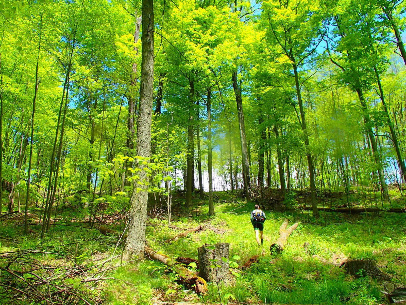
This bike leg would take
us primarily on dirt roads through the bucolic forested local terrain, as we
picked up a few easier CPs along the way. The first major task on the bike was
a steep road grade, possibly private (we honestly couldn't tell) that gained us
about 700 ft of elevation over only a mile (did I mention it was steep?). After
this we pretty much cruised easily on more level roads, had one more big climb
(500 ft) and had a few long, fast descents. We spent a lot of this leg chatting
alongside the Mercators team, who we've raced against many times over the
years. While covering 36 miles, this leg was pleasant and straightforward, and
we rolled into the next TA at dusk with plenty of gas in the tank to begin the
2nd half of the race. RD Brent was serving up hot grilled cheese at the TA
which was worth its weight in gold at this point.
At this TA, in McIntyre
Wild Area, we would begin a night trekking loop with nine CPs available. None
of the CPs were on a trail and many were well removed from easy navigation
features. Compounding the technical nature of this task was darkness.
Navigating in the woods at night is notoriously tricky, distances and terrain
features become difficult to judge. We also knew, from knowing Brent's style
and inspecting the maps, that there would be several very challenging flags out
there. We could get the CPs in any order. We began with a pretty easy find
across the rushing Rock Run. Following this was a hilltop CP which looked to be
in a poorly defined "saddle" - a lower corridor between 2 soft peaks.
We found it, in a very WELL-defined saddle, but it took almost 2 hours. The
next 3 were on creeks and not too tricky but took some time covering distance
and descending technical terrain. We then cranked steeply uphill to another
pretty easy flag before setting off over several km on a plateau for the next
CP, T. The map showed a stream leading right to the target but as we feared might
happen, the stream broke up and essentially vanished far before we got there.
We used some other features, reattacking and eventually finding it after
spending a chunk of time. 40 minutes of trekking, with more technical steep
descent, and we were back at the TA, 21 hours into the race (4:00 AM).

Patch
of Lady Slipper on night trek, with artsy headlamp vignetting.
|
The final stage would be
a bike back to the Forksville fairgrounds, where we had started. We had been
told it would take a minimum of around 3 hours to complete this leg. But, for
the willing and able, there were up to 5 optional CPs to be gained. Leaving the
TA around 4:30 gave us 5.5 hours until the finish time cutoff and we were keen
to scoop up as many of those CPs as we had time for. Although were technically
on "roads" for the first 40% of this leg, they were more like
neglected road grades that hadn't seen a large vehicle or chainsaw in many
years. So, the surface was soft, there were lots of fallen trees and
face-high saplings/branches and generally uphill. Consequently, it was 90+
minutes to cover the first 5 miles of the leg, with no nav problems.
One moment of comic
relief: As we near the end of this slow bike section, the "road"
intersects a 10-foot deer fence. We had been through a couple deer fences on
the first trek and were familiar with the little hatch you swing open to pass
through. This one did not seem to have a hatch, though. We checked a couple
padlocks on it but, no dice. After a minute of befuddlement, Rob climbs to the
top, straddles it and I hand up our bikes which he deposits on the other side
before hopping down. Once down, he places a hand on the fence and a large, standard
door-size panel swings easily open and I walk on through.
Shortly, we were on
pavement and zooming downhill and cruising flats, followed by some easy dirt
road terrain to pick up CPs U and V with no difficulty. We still had 3 hours
until the finish and things were looking promising to clear the bike leg. So we
continued on rural roads and then easy forest roads to grab CP W on Bearwallow
Pond. Now we had a little over 2 hours to pick up the final CPs and cruise to
the finish. Given the easy terrain and easily found CPs thus far on the leg,
this seemed very possible. We hadn't seen any teams around in a couple hours
and felt like we were making a strong move to finish the race. 10 minutes later
we arrived at the "trail" system where the final 2 CPs on the leg
were located. Pace slowed immediately because of the unmaintained nature of
these road grades and the non-straightforward trail layout relative to what was
mapped. We were still feeling pretty good though as we dropped into a stream
gully where we expected to descend to CP X at a waterfall. This is when the
wheels started to come off. We were obviously tired and thus not navigating at
a high level. We were also hurrying a bit because of the clock ticking in our
heads. There was also a point of confusion in that there was more water on the
ground than the maps suggested. The stream valley we were in had a rushing,
significant flow and lots of small/medium waterfalls. It seemed like we had to
be in the main stream valley rather than where we actually were - an upstream
reentrant without even a blue line mapped at its bottom. Then I sighted a trail
feature which exactly matched one near the CP and thought I knew exactly where
we were. This was upstream from a confluence which I mistook for a very
topographically similar one downstream, cementing my incorrect conviction
about where we were. From this point on, we never actually knew where we were and
spent too much time incredulously finding zero CPs, hiking rocky stream gullies
in bike shoes and dragging our bikes through the steep woods. Because we were
incorrect about our location, the bailout haul-ass-to-the-finish option was
also seriously delayed. Thus, when we emerged onto a road and began riding full
speed toward our best guess of the direction of the finish, we were probably
out of time to make the 10:00 AM time cutoff. On our Hail Mary all-out ride
back, Rob's derailleur decided to suddenly start rubbing on the spokes, stopped
tensioning the chain and began dropping the chain every couple minutes. At this
point it was obvious that we would be over time. Our hope of a good race finish
was officially gone. We rolled into the finish line as race awards were
commencing, 19 minutes overtime, hemorrhaging CPs by the minute as a penalty
for our lateness.
Despite the poor
official final ranking, we felt pretty good with how we raced. Only 3 teams
found more CPs. We learned some lessons about end-of-race management, and like all races, logged some navigation and strategy
experience.
We loved this area for
AR - rugged, forested, sparsely peopled. The designed course was also a hit -
tougher nav than we usually see (not necessarily a bad thing), featured some cool terrain and was very
well-organized overall. Rootstock definitely know what they are doing, we'll be
looking forward to our next race with them.
No comments:
Post a Comment