The day and night before the race brought a long soaking rainstorm. We knew the trails and woods would be soaked for the race. But that's okay, wet feet can be tolerated for a 12 hour race and all the teams would be laboring under the same conditions.
After a solid 2 hours of hot, mosquito-riddled sleep the night before, it was off to a 5:00 start. We got our maps, the race began, and we were off on foot for the first 6 CPs. Our shoes were submerged in water within 3 minutes. This was a moderately challenging stage involving trail and road running, hill ascending and some swamp traversing before arriving back at the Blueberry Hill Inn to transition to bikes. We had a few minor hiccups on this section early, but finished stronger and rolled into TA1 tied for 7th overall and 4th in our division. This year there were 33 teams, 19 of which were in our division.
The first bike leg gave us an idea of the condition of the trails: pretty soft with many sections of wheel-sucking mud. 3 widely-spaced but easily-found CPs followed. After the muddy first 2 CPs we were excited to see an upcoming gravel road section on the map. Surprise! The gravel was loosely packed, kind of rounded stone, and about 3 inches deep and left all of us vainly shifting lines trying to find an even slightly compacted vehicle track. At least it was mostly downhill and was definitely a faster surface than the trails. At the end of this, a short hike-a-bike section lead to TA2. This TA found us tied for 7th place overall and tied for 3rd place in our division.
The next section (trek/swim) was 4 CPs in any order. First we tackled CP 10 atop Sugar Hill, about 325 feet above us. Then we quickly grabbed the next 2 points, the last, CP 11, involving some nice cooling pond-coasteering before gearing up for the swim to CP9 on an island. The swims to and from the island were a nice cooling break and we rolled into TA3. At this point we had moved up to 5th overall and we were nipping at the heels of our division leader (and eventual division winner) Sunrise Adventure, 12 minutes ahead of us.
Reversing the short hike-a-bike, now uphill, we traversed a couple miles of gravel road to the Widows Clearing trailhead. This was a tough trail. I am incredulously looking at the map now and seeing only about 300 feet of gain on this trail over about a mile and a half. Barring local tectonic plate upheaval since the last USGS survey, I will have to attribute the grueling feel of this trail to slow, muddy surface conditions and the fact that we already had about 5 hours of this race in our legs. Grabbed 2 easily located CPs and then south on gravel toward the next TA. This gravel road, though climbing about 375 feet over a couple miles, was thankfully packed and a welcome reprieve from rolling resistance. Then more gravel road, mostly downhill to TA4 atop beautiful Voter Brook Overlook. A quick water refill (which we had been banking on - thanks GMARA!) and then onto the next trekking leg. At this point we were still in 5th overall and second in our division, just 17 minutes behind Sunrise. There was a 2:30 time cutoff to make it back to TA5, which we should have had no problem making at our current pace.
Next, a brisk downhill jog to CP 15, losing tons of elevation, where we eventually found the CP atop a rock face and manned by climbing personnel. Nick quickly donned harness and helmet and scampered up to the point to punch the passport. After a very rapid descent (and a couple minutes of rest for Rob and I), we set off toward CP 16, now just 7 minutes behind Sunrise. After regaining a bit of elevation we actually met Sunrise at CP 16. We made a hasty U turn and grabbed CP 17 just about a minute ahead of them after gaining back some more elevation. CP18 followed a steep descent and ascent to about 1560 feet, we nailed this CP in stride with a perfect compass bearing and set off for CP 19, presumably leading our division at this point. CP 19 would be our final checkpoint, however, as what had been a good race for us so far soon unraveled.
Our compass bearing was a little off and we lost a little time finding the trail adjacent to CP19, but made a relatively quick recovery and headed down North Branch Trail to what looked to be an easy CP19. We descended to the stream where the CP was, but ended up further upstream than we should have been due to faulty map reading, poor distance estimation and erroneous altimeter data. We must have spent over an hour wandering around finding this point, eventually spotting it only 30 feet past where we had turned back upstream initially. By the time we found the CP, the time cutoff had just elapsed and a quick hustle back up to TA5 left us 18 minutes beyond the 2:30 cutoff. A 25 minute bike to the race finish found us at a very empty race HQ. Although there was over an hour and a half until the 12 hour mark, our race was over. This was pretty tough to swallow, like some kind of...pill that tastes really bad, or something. The only other team at the finish was Untamed New England (aka Granite AR - 2009 USARA national champs), who had bagged all 23 CPs and still beat us to the finish line by 25 minutes in a dominant performance.
Why didn't we abandon CP 19 to make sure we made the 2:30 time cutoff? Um, well...not sure really. It was a very bad oversight on our part. I think the main factor was that, to that point, we had never skipped a CP, in 4 adventure races, so it wasn't an obvious option to our team mindset. The other factor was the feeling that we had to be right on top of the point and just barely missing it (which turned out to be true). The other, I guess, was that 2 hours of sleep and 9 hours of full-on racing may have impaired the decision making process. Although we were obviously not excited about the early truncation of our race, the blame lies wholly with us for not making the cutoff. Race staff made us fully aware of the time cutoff before the leg. The minor upside of all this was ample time for a trip to nearby Brandon, VT for a couple beers on the porch at Sully's while most of the other teams finished out the 12 hours.
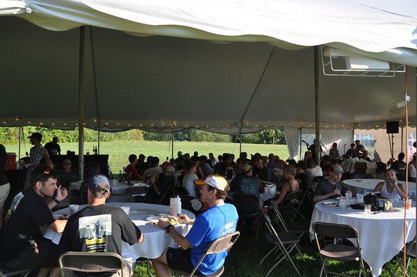
The after-race dinner was lavish including a tasty buffet and live music under a tent in the now-perfect weather. This year's course was tough, excellently laid out and expertly run, as usual, by GMARA. We can't thank the GMARA staff and volunteers enough for doing what they do to put these races together. Hopefully another Bitter Pill lies in the future. If so, we will definitely be there and, hopefully everything will finally come together for us in this race.
Stats (courtesy GMARA, our bike computer and altimeter)
Total elevation change: 12,637 ft
Start/Max elevation: 1635/2290 ft
Total bike: 19.8 mi over 2 hrs 23 min (includes hike-a-bike)
Finish: 6th place out of 19 in division, 11th out of 33 in race
All photos courtesy of GMARA
 |
| Pre-race, about 4:40 AM |
 |
| Less than a minute into the race. Running past the Blueberry Hill Inn, Goshen, VT. |
 |
| Rob and Nick at CP5. There were several teams here. |
 |
| Running during first leg between CP5 and CP6. |
 |
| Bikes at TA1 waiting for us to return. |

Navigation by consensus. This is what works best for us.
 |
| Sugar Hill Reservoir. CP 9 was on this island. |
 | ||||
| Shortly after leaving TA2
|


Leaving TA3, back to bikes and having moved up to 5th overall.
 |
| At TA 4. The art of map folding: part origami, part "it's good enough, lets go" |
 |
| Nick climbing to CP15. |

Punching CP15. Still among the race leaders at this point.
 |
| At TA5. Cut off. Sense of urgency being replaced by sense of disappointment. |
 |
| At TA5. First visualize hydration, then drink. |
 | ||
| Rob bringing us home at the race finish.
|
Can you tell me what your training looked like for this race? I am going to sign up for my first one this summer.
ReplyDeleteAwesome! The basic necessities would be bike endurance (being okay with multi-hour rides with hills), basic mountain biking skills (trail riding), being comfortable on your feet for 6-10 hours (hiking +/- running), very basic canoe skills and the ability to understand a topographic map. You can scale the training hours/intensity up or down as you like depending on how competitive you want to be on race day. Good luck!
ReplyDelete