From SectionHiker.com: One of the great hikes in the White Mountains of New Hampshire is called a Presidential Traverse. It’s so-called because hikers climb all of the mountains in the Presidential Range of the White Mountains in one continuous hike that’s nearly 23 miles long with close to 9,000 feet of elevation gain
Rob and I each bagged 2 hrs of sleep Thurs night prior to a very early Seacoast departure for a 5:30 AM rendezvous with Kyle and fellow AR strongman Jason Urckfitz. For various reasons, other invitees couldn't make it and we were the 4 remaining. Rob and I had a little anxiety about keeping up with these horses for a day-long hike but it wasn't an issue. The pace would be deliberate but moderate overall with short stops for views/snacks etc.
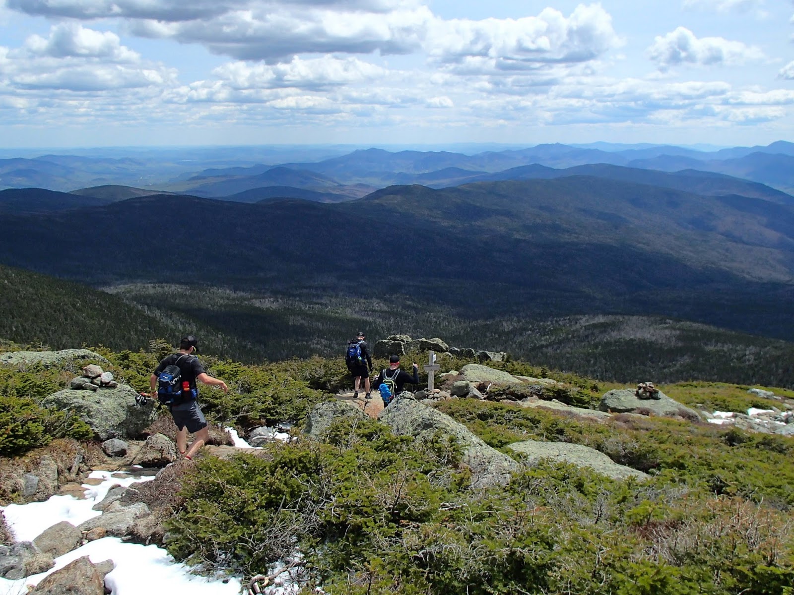
We dropped a car at the endpoint (Elephant Head on Rt. 302) and drove ~30 mins to the start at Appalachia trailhead on Rt.2. The first task was to climb almost exactly 4000ft in only 3.6mi to reach the summit of Mt. Madison. This began as a moderate climb and then a steep climb through forest before breaking out above treeline for some stunning panoramic views (which we would have for much of the next 6 hours).
 |
| Morning from Mt. Madison |
Once above treeline, the terrain changed to a giant pile of boulders. This would persist for the next 2 peaks as well (Adams and Jefferson). Its a challenge to move with speed across a pile of boulders, especially when you would occasionally slip on their dry-appearing green lichen coating.
 |
| Jason. Boulder scree descent |
 |
| Kyle. Boulders. Lots of boulders. |
After the first few peaks, the boulders let up a little and we would hike on small boulders, gravelly stuff and even a few patches of dirt. The ascent of Mt. Washington was actually pretty easy, only a moderate climb compared to the earlier peaks. At the summit of Mt.W, which was about the halfway point, we took 20 minutes to grab a seat on an indoor bench and enjoy a drink and a snack. We cooled off a bit at this point. Temps has been 40s to 50s but we were working hard on some climbs (and descents - did I mention they were bouldery?) and feeling warm. Once we stopped moving on the top of 40 degree Mt.W, we started to cool off and each added a layer and gloves before resuming the trek. These items were removed shortly however, as we worked up a sweat in the beautiful sun at 5000ft on our next descent/ascent toward Mt. Monroe.
The next few peaks (Monroe, Eisenhower and Pierce) involved relatively short climbs and overall better footing/groundspeed, with an occasional runnable stretch of trail. Spectacular weather and views were the norm for this highly enjoyable section.

The last part of the hike - to Mt. Jackson and the descent to the dropped car - were below treeline. This meant lots of typical White Mtns terrain - wet, rocky, rooty trails as well as a few areas of iced-over trail. For some reason I had been sweating my ass off during this traverse despite the relatively cool temps and not-excessive pace. I had plowed through my 2.5L of water and had been eating handfuls of alpine snow at every opportunity but I was out of water and very thirsty. Kyle lent me a full bike bottle (which I subsequently refilled twice at streams) and Jason offered a big slug of nuun but dehydration persisted. After we finished, I polished off half of a water bottle in my car and consumed 2 LARGE drinks from McDonalds and still had no need to use the bathroom until after 9 PM that night. I am a generally sweaty, heat-intolerant guy but this was a new low.
We continued on the wooded trails, made one short nav error and then headed up to Mt. Jackson. I just learned that Mt. Jackson is named after Charles Thomas Jackson, a geologist and not Andrew Jackson the president. Thus, Mt. Jackson need not be included to qualify as a Presidential traverse. We got our last wide-ranging views from Mt. Jackson and then headed down 2.6 miles to the car. 2.6 mi downhill sounds easy but it really wasn't. Most of this section was steep technical rocky downhill which was slow and not super comfortable on worked-over quads. Not my favorite hiking terrain but these ancient eroded streambeds which pass for trails are typical in the Whites. It's probably good training for something.
Kyle had had enough of our slow downhilling and skipped ahead for last bit and we met back at the car to upload data and change out of wet shoes and clothes (in that order) before shuttling back to the other end of the traverse and settling into the 2.5 hr drive home.
We were very lucky with our weather for the traverse. I kept thinking about how lousy (to be frank) this hike would be if you were stuck in a cloud and hiked for 10-11 hrs without any decent views. With stops, we clocked in just under 11 hrs for the trek, covered 21.4 mi and climbed just over 9000 ft.
This comment has been removed by the author.
ReplyDelete